A plan on paper.
A clearer picture of the place.
At our family farm on the Cumberland Plateau, the owner had a master plan built on an existing survey. What he wanted to understand next was how the buildings on that plan related to the buildings actually there.
How closely does the plan match the place?
A boundary survey and an owner’s building plan answer different questions. The owner had added buildings and utilities to an existing survey sheet, but was unsure how closely those drawn building positions matched the property.
We used aerial imagery to identify visible roof outlines and prepared an annotated comparison. The useful result was a shared picture: the owner could see where the plan and the capture differed and which questions deserved a closer look.
Make the differences easy to see.
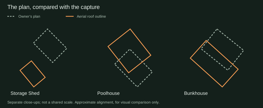
Dashed: owner’s plan. Orange: aerial roof outline.
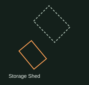
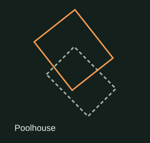
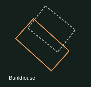
The comparison made differences in the planned placements visible. It also made the limits visible: a roof edge is not a wall face, the corner monuments were not observed, and the overlay was aligned approximately rather than established on survey control.
This family exercise demonstrates visual interpretation. It does not establish property boundaries, setbacks, an encroachment or a permitted location for a new building. Measured overlays and distance tools require separate scope review before commercial delivery.
The original sheet was a preliminary 2018 survey copy. The imagery for the building comparison was captured on July 23, 2026, and the annotations were prepared on September 11. The 3D examples below come from earlier July work; they are separate captures.
Different views of the same property.
The July 10 mapping capture produced the aerial overview, point cloud and textured model below. A separate orbit supplied the poolhouse’s photoreal model. These are demonstration views, not certified measurement products.
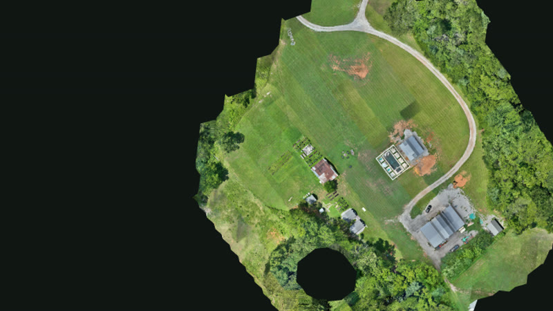
Orthomosaic
A stitched aerial image that helps you see the property as a whole. The pixel size describes image detail, not verified positional accuracy.
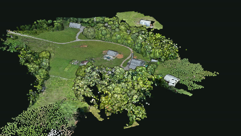
Point cloud
A point-based reconstruction of visible surfaces. It is shown here as a technical demonstration; gaps and artifacts remain where the capture could not resolve detail.
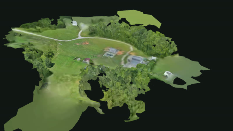
Textured 3D mesh
A solid, walkable model of the property — the spinning reconstruction at the top of this page.
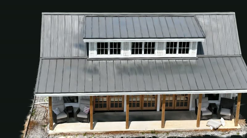
Photoreal splat
A near-photographic Gaussian-splat reconstruction of the pool house — from a separate, purpose-flown orbit (see below).
You can't fix capture geometry in post.
Then we pushed it. We took that same nadir mapping data and asked the pipeline for a photorealistic 3D model of the property. The buildings came out convincingly — the pool, the deck, the lawn furniture, all recognizable. But every patch of grass rendered as a field of needles, and the ground at the capture's edge bowed upward like the rim of a bowl.
Our first instinct was cleanup: filter the stray blobs, cut the low-confidence geometry. It helped at the margins and then hit a hard ceiling — because the spikes and the bowl were the geometry, baked in at capture. A camera that only ever looked straight down has never seen the side of anything, and no amount of processing can supply information the flight didn't collect.
So we flew the control group. That same week we ran a manual double orbit around the farm's pool house — two rings at different heights and radii, camera looking in. Oblique geometry: the flight sees walls, eaves, corners, the undersides of things. From 317 frames, 307 locked into a single clean solution, and the splat that came out renders near-photographic. Same aircraft. Same camera. Same processing pipeline. The capture geometry made the difference.
Every deliverable has a capture geometry it wants — and the two families don't substitute for each other. The one thing we can't do is fix capture geometry in post.
Start with the question you want to answer.
A Property Overview helps you discuss a place. Atlas Worlds lets someone explore it remotely. A Site Record shows its visible condition at a particular time. Each starts with the views and context that will be useful to you.
If your decision involves building placement, boundaries, design, permits or quantities, say so at the start. Those uses need a separate scope review and the appropriate professional involvement.
Your site, in this detail.
This family demonstration shows the value of a clear visual explanation. Tell us about your property and the question you want to answer, and we will discuss the right scope.